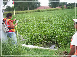
 Amani has four survey crews complete with modern field equipment including Total Station and data collectors. Surveying services include topography, boundary, ALTA, ROW verification, easement surveys with metes and bounds, platting, re-platting, elevation certificates, as-built surveys and construction staking. We understand the connection between surveying and engineering to provide precise and reliable data. Our state-of-the art surveying instruments, electronic data collectors, GPS capability and computer systems allow us to provide quality services for our clients with superior results – cost savings, efficiency and reliability.
Amani performed surveys within public and private Right-of-Ways for design of water lines, storm sewers, sanitary sewers, utility design of a plat, parking lots, develop contour maps and easement acquisition.
- Site Topography
- Boundary Survey
- Route Topography
- Design and Construction Survey
- Right-of-way Maps
- Easement Survey
- ALTA Survey
- Legal Descriptions
- Elevation Certificate